Konkan Infrastructure Investment Guide

Revas-Reddi Konkan Coastal Highway Development : Plot Prices Set to Rise

8 creek bridges. One continuous konkan coastal highway.

11 min read Published 24 July 2026 · Key2Home.in Research

For decades, the Konkan coast has had one problem that kept it a hidden gem instead of a mainstream second-home market: the creeks. Nine major creeks slice the coastline between Raigad and the Goa border, and every one of them has forced travellers onto long inland detours or monsoon-suspended ferries. That problem is now being solved — bridge by bridge — and the investors who understand the map are moving before the ribbon-cuttings.

The Revas-Reddi Konkan Coastal Highway (MSH-4, also called the Sagari Mahamarg) is the single biggest infrastructure story on Maharashtra's coast today. In this guide, we break down what the project actually is, which bridges matter for which locations, and why Alibaug, Anjarle and Dapoli sit directly in its path of appreciation.
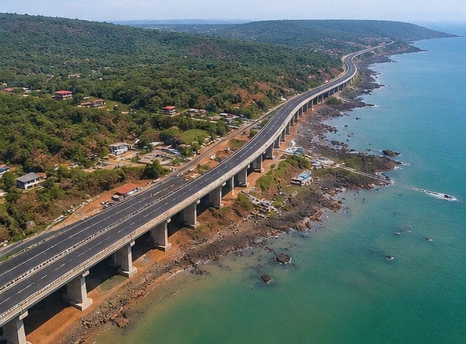
Revas Reddi Coastal Highway MSH-4 route along the Konkan coastline Maharashtra
The Konkan coastline the Sagari Mahamarg will finally stitch together — creek by creek, bridge by bridge.

What Is the Revas-Reddi Konkan Coastal Highway (MSH-4)?

The Revas-Reddi Coastal Highway is a 498-km coastal route being developed by the Maharashtra State Road Development Corporation (MSRDC), running from Revas in Raigad district all the way to Reddi near the Goa border. The state has envisioned it as Maharashtra's answer to California's Pacific Coast Highway — a scenic, all-weather drive hugging the Arabian Sea.

Here is the key point most coverage gets wrong: MSH-4 largely already exists as a state highway. What has always broken it into disconnected fragments are the creek crossings. The project's core is therefore a series of new creek bridges — seven of the nine major bridges have already been awarded — plus widening and resurfacing of the connecting road. Once the bridges open, a road that today works only in pieces becomes one continuous coastal corridor.

One clarification before we go further, because buyers frequently confuse the two: the Revas-Reddi Coastal Highway is not the same as the proposed greenfield Konkan Expressway. The Expressway is a separate, access-controlled inland project still in planning stages. MSH-4 is the coastal route, it is under active construction, and its bridges are the near-term event that changes drive times.
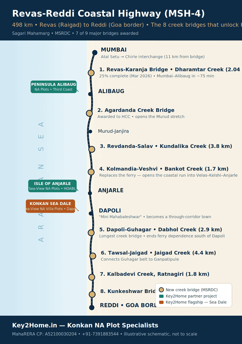
Route map of the Revas-Reddi Coastal Highway (MSH-4) showing all 8 creek bridges and Key2Home Konkan projects Tap to zoom
The MSH-4 corridor and its 8 new creek bridges, from Revas to the Goa border. Illustrative schematic, not to scale.

Revas-Karanja Bridge: Alibaug's Game-Changer

The flagship structure of the entire project is the Revas-Karanja bridge across Dharamtar Creek, connecting Karanja (near Uran) with Revas (near Alibaug).

Where the project stands

Afcons Infrastructure is executing the bridge on EPC mode. The full project spans about 10.65 km including approach roads, with the main creek crossing of roughly 2 km built as a four-lane structure designed for 80 km/h. As of March 2026, infrastructure trackers reported the bridge had crossed the 25% completion milestone, with progress running ahead of its 30-month contract schedule. Some approach-road land parcels are still being acquired, but the creek span itself is moving steadily.

What it changes

  • Uran to Alibaug: from over 2 hours to about 30 minutes. Today's road route is a 70-km detour around the creek. The bridge replaces it with a direct crossing.
  • South Mumbai to Alibaug: about 1 hour 15 minutes. The bridge lands roughly 11 km from the Atal Setu's Chirle interchange, which means the sea link and the coastal highway click together into one continuous fast corridor.
  • All-weather certainty. The Revas-Karanja ferries shut down every monsoon, cutting Alibaug's fastest link for months at a time. A bridge does not take the season off.
  • Airport connectivity. The same corridor ties Alibaug to the Navi Mumbai International Airport catchment — a detail that matters enormously to NRI buyers planning fly-in weekends.

For anyone tracking NA plots in Alibaug, this is the connectivity event the market has waited a generation for. Alibaug's transformation from ferry-dependent getaway to a genuine drive-to suburb of Mumbai is no longer a forecast — it is a construction schedule.

Key2Home.in · Konkan NA Plot Specialists

Planning a Konkan site visit?

Tell us which belt is on your shortlist — Alibaug, Anjarle or Dapoli — and we will plan the drive, the projects and the paperwork checks.

Bankot and Dabhol Creek Bridges: Dapoli and Anjarle Join the Fast Lane

Alibaug gets the headlines, but the bridges further south are where the more interesting investment math lives — and almost nobody is writing about them.

Bankot Creek bridge — the Mumbai-side key to Anjarle

Driving down the coast from the Alibaug-Murud belt today, the journey breaks at Bankot Creek, where the Veshvi-Bagmandla crossing depends on a ferry. MSRDC has tendered a 1.7-km bridge connecting Kolmandia and Veshvi across this creek. When it opens, the coastal run from Mumbai flows uninterrupted into the Velas-Kelshi-Anjarle stretch — the exact belt where Isle of Anjarle by House of Abhinandan Lodha is located. Anjarle stops being the far side of a ferry and becomes a straight coastal drive.

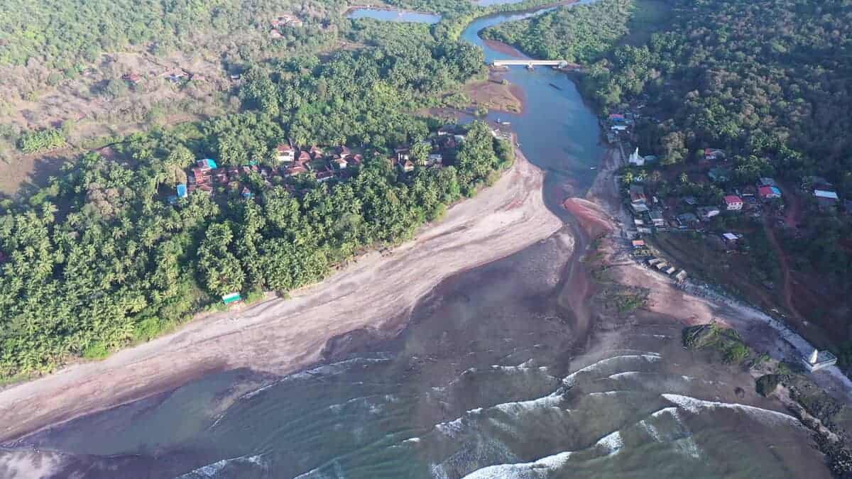
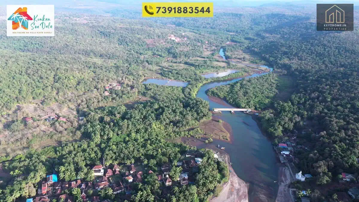
Revas Karanja bridge over Dharamtar Creek cutting Mumbai Alibaug travel time to 75 minutes
The Dharamtar Creek crossing — flagship of the eight new bridges that end the Konkan coast's ferry era.

Dabhol Creek bridge — Dapoli becomes a through-corridor

South of Dapoli, the highway again breaks at Dabhol Creek, where a vehicle ferry connects Dabhol with Dhopave near Guhagar. MSRDC has tendered a bridge of approximately 2.9 km connecting Dapoli taluka with Guhagar taluka across this creek — one of the longest structures on the entire highway.

This bridge changes Dapoli's position on the map in a subtle but powerful way. Today, Dapoli is effectively a destination you drive to. With the Dabhol bridge, Dapoli sits on the continuous coastal highway — every vehicle travelling the scenic route between Mumbai and Goa passes through its doorstep. Destinations on a through-corridor historically see hospitality, retail and land demand compound in a way dead-end destinations do not.

Dapoli already has the fundamentals: it is celebrated as "Mini Mahabaleshwar" for its climate, hosts the Konkan Krishi Vidyapeeth agricultural university, and offers a run of beaches from Karde and Murud to Harnai and Anjarle. For buyers evaluating sea-view NA plots in Dapoli, the coastal highway adds the one ingredient the region lacked — effortless access.

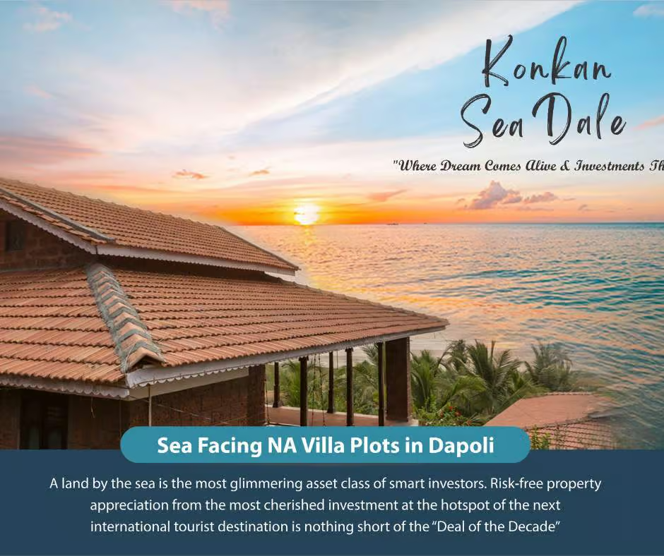
Sea view NA villa plots near Dapoli and Anjarle on the Konkan coastal highway corridor
The Dapoli-Anjarle coastline — the stretch of coast the continuous highway puts within an easy drive.

Which Konkan Belt Benefits Most?

Not every stretch of the coast benefits equally or at the same time. Here is how the three key belts compare:

Belt-by-belt comparison Swipe on mobile →
Belt Access today Access after MSH-4 Market maturity Typical buyer
Alibaug (Revas-Murud) Ferry or 2+ hr road detour from Uran side; Atal Setu partway ~75 min from South Mumbai via Atal Setu + Revas-Karanja bridge Most mature; celebrity-driven demand already established Mumbai HNIs seeking a weekend estate on a short drive
Anjarle-Dapoli (Ratnagiri north) Inland highway route from Mumbai/Pune; ferry breaks on coastal route Continuous coastal drive after Bankot + Dabhol bridges; through-corridor status Early-cycle; branded developers have just arrived Investors and second-home buyers seeking the bigger appreciation runway
South Konkan (Ratnagiri south-Sindhudurg) NH-66 inland; coastal route heavily ferry-dependent Jaigad, Kalbadevi and Kunkeshwar bridges connect it in later phases Earliest stage; longest horizon Patient land bankers and Goa-overflow buyers

The pattern for infrastructure-led appreciation is well documented: land values move in stages — at announcement, at visible construction, and at commissioning — with the steepest percentage gains typically captured by those who entered during the construction phase, a dynamic consistently noted in Indian market research by firms such as JLL and Colliers on corridor projects like the Atal Setu. Alibaug is furthest along that curve. The Anjarle-Dapoli belt is where the curve is still early — which is precisely why it deserves attention now.

The Investment Window: Why Timing Matters

The Atal Setu offers the closest recent case study. Interest in Alibaug and the Raigad coast accelerated sharply while the sea link was under construction, not after it opened — by opening day, the early appreciation had already happened. The coastal highway's bridges are now at that same construction-visible stage.

Honesty matters more than hype, so three watch-outs every buyer should weigh:

  • Timelines can slip. The overall project targets completion around the end of 2026, but alignment disputes and land-acquisition issues — including farmer protests on certain southern stretches — mean individual sections may take longer. Buy for a 3-7 year horizon, not a six-month flip.
  • Not every plot near a highway is a good plot. Coastal land comes with CRZ (Coastal Regulation Zone) rules that restrict construction within notified distances of the high-tide line. A legitimate NA (non-agricultural) plot in a planned project outside CRZ restrictions is a completely different asset from an unverified gunthewari parcel by the beach.
  • Verify before you pay. MahaRERA registration, a clear NA order, clean 7/12 extracts and marketable title are non-negotiable. Branded, RERA-registered plotted developments exist in this belt precisely so buyers do not have to gamble on paperwork.

How to Buy Safely Near the Coastal Highway

A short checklist we walk every client through:

  1. 1RERA first. Confirm the project's MahaRERA registration number on maharera.mahaonline.gov.in before any site visit conversation gets serious.
  2. 2NA status in writing. Ask for the NA order/sanad — not a verbal assurance that conversion is "in process".
  3. 3Title and 7/12. Have the 7/12 extract and title chain reviewed by a lawyer independent of the seller.
  4. 4CRZ position. For coastal plots, confirm the project's position relative to CRZ lines on the approved plan.
  5. 5Access and demarcation. Check the approach road's legal status and insist on physically demarcated plot boundaries.

For a broader view of where the Konkan corridor fits among India's plotted-investment destinations, see our guide to the top locations for plot and villa investment in India, or explore the full range of NA plots in Konkan we currently recommend.

Before the bridges open

Planning a Konkan site visit?

One drive covers Dapoli, Anjarle and the coastal route itself. We handle the itinerary, the RERA checks and the paperwork questions.

Frequently Asked Questions

The Bottom Line

The bridges are being built either way. The only real question for a Konkan investor is whether they buy while the cranes are still standing — or after the first traffic crosses and the market has already re-priced.

If the coastal highway map above puts Alibaug, Anjarle or Dapoli on your shortlist, a site visit will tell you more than any article can.

Key2Home.in Properties is a MahaRERA-registered real estate channel partner (CP: A52100030204). For site visits and current availability across our Konkan portfolio, call or WhatsApp +91-7391883544.